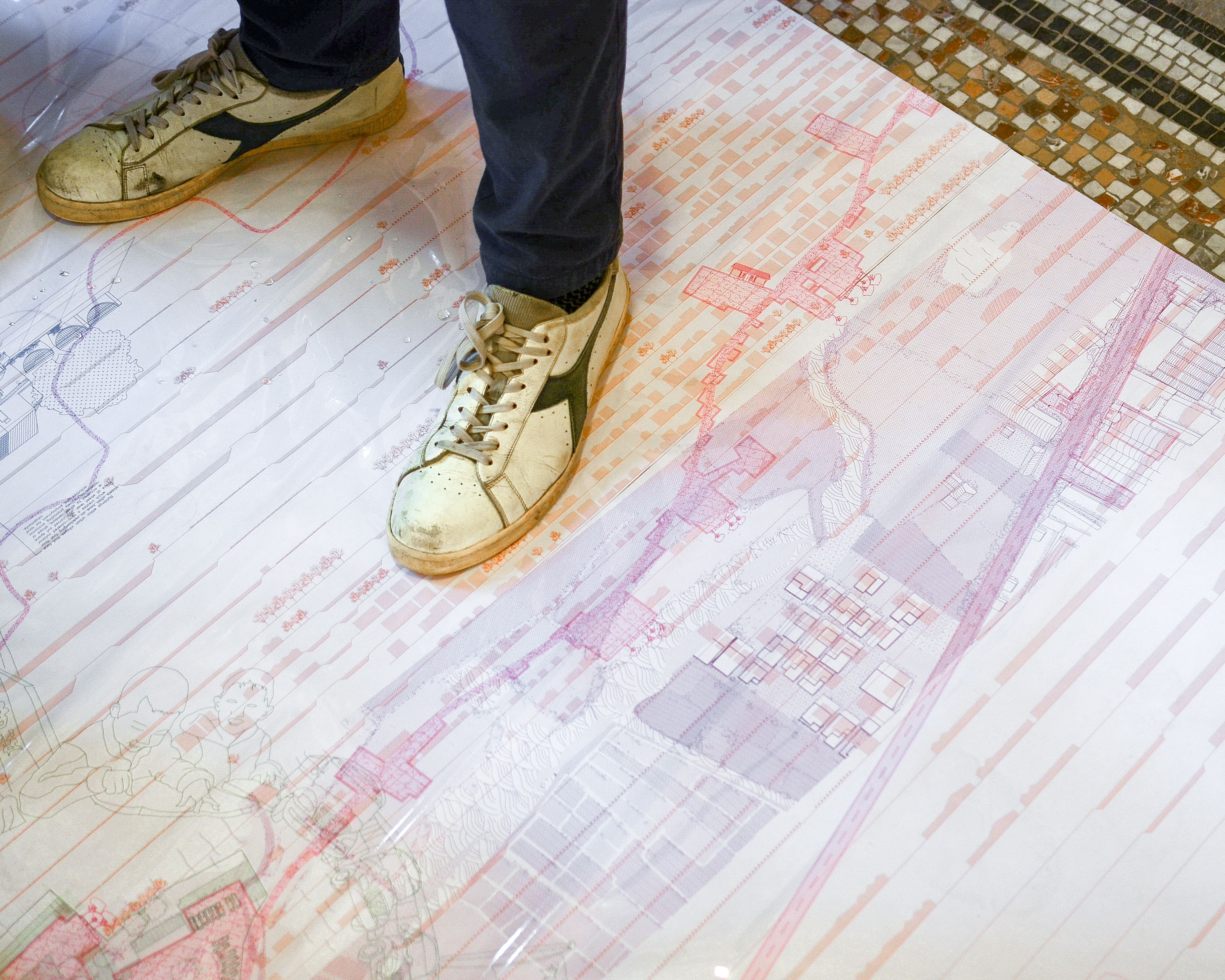
The Yield of the Land
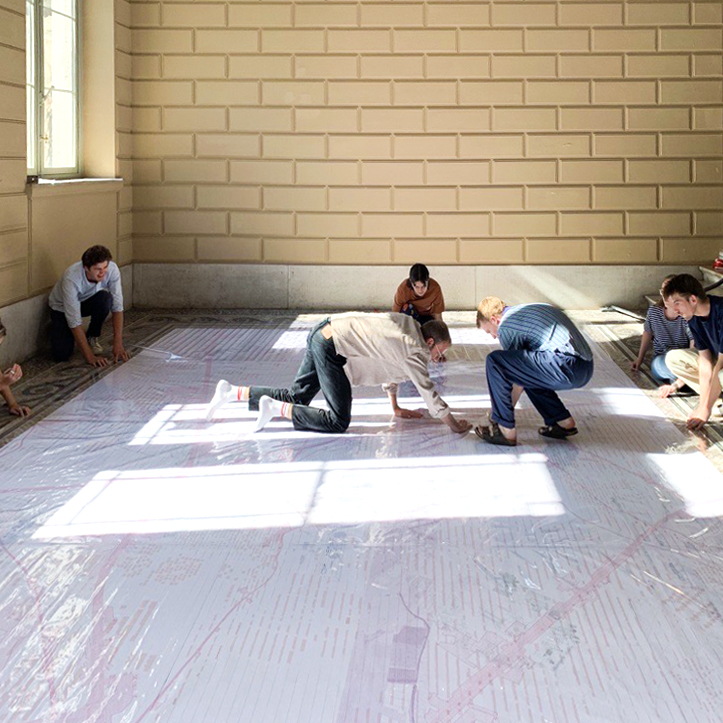
a room-filling, collaborative drawing of a landscape in Nanhai District, Pearl River Delta, China.
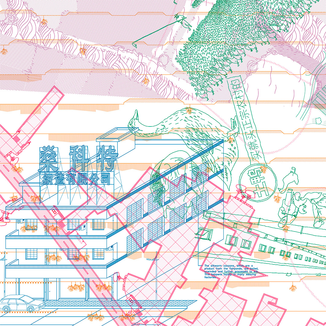
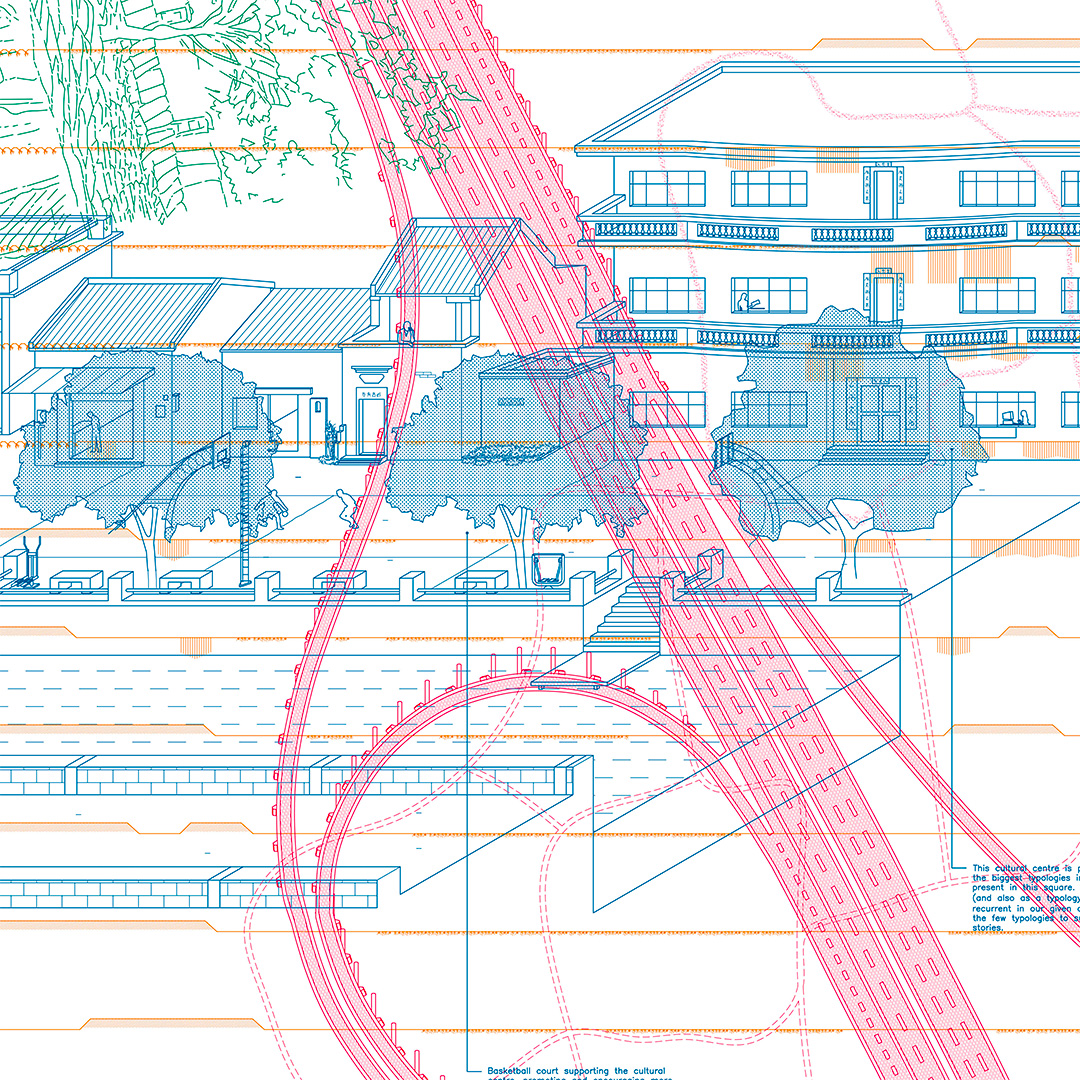
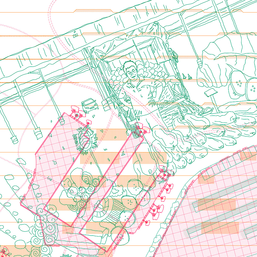
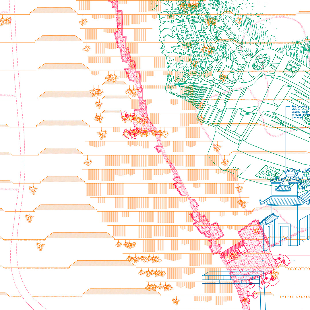
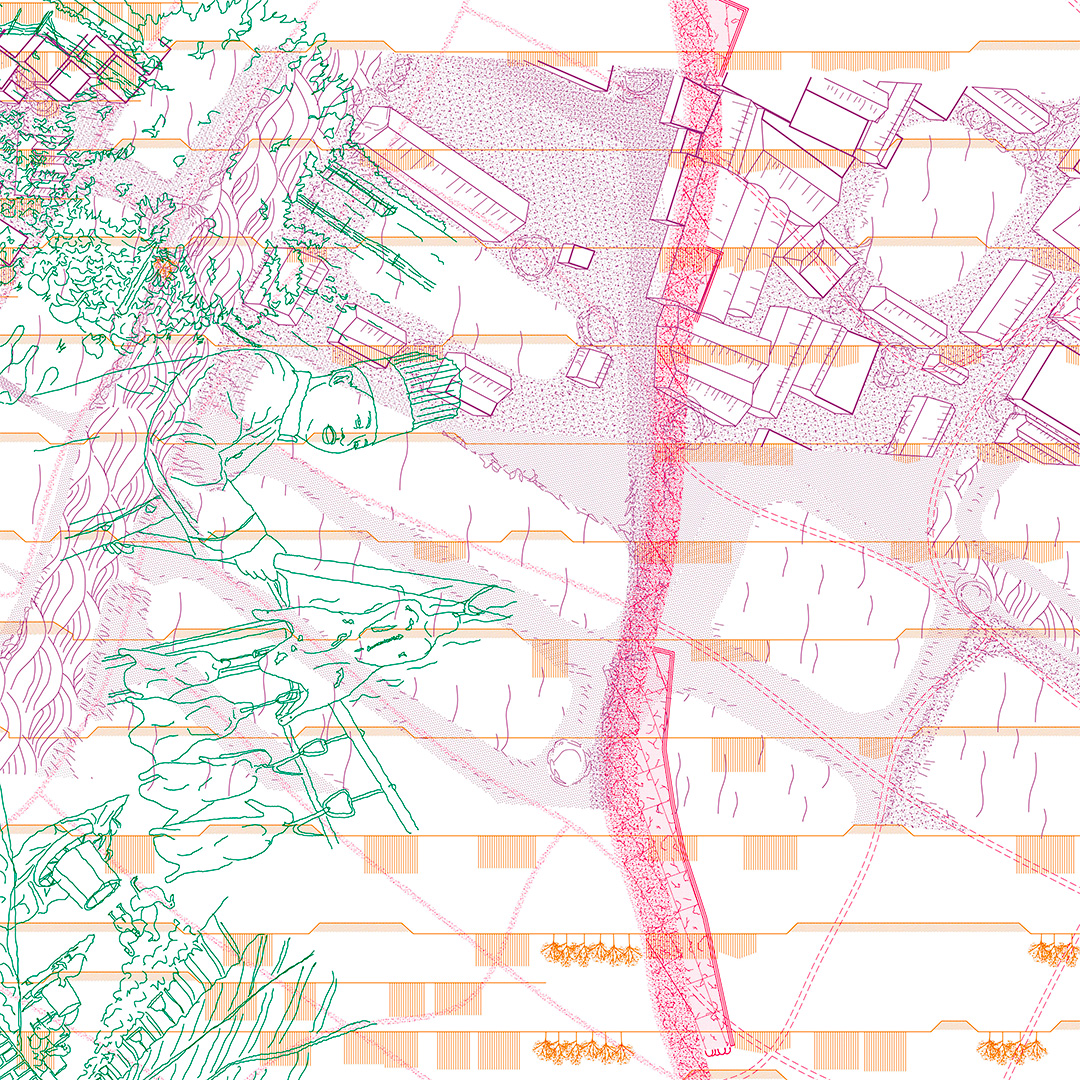
This room-filling vectorial drawing aims to explore the transformation of the productive landscape of the Pearl River Delta over a duration of 50 years. A fragment located in Nanhai district in the heart of the Delta—a landscape unreachable and alien in many ways too most of us—was selected as our site. This area, measuring 5 by 3 km, was then scaled to 1/750. Eightteen students explored a landscape they were unable to visit, using as their primary source satellite images.
Looking through different thematic and graphical 'lenses', the drawing became the tool to bridge the gap between China and Belgium, not to offer definitive answers, but to open up new knowledge on the landscape. To draw is in fact to select, omit, isolate, order, ... It directs the gaze and prompts questions, as each line requires a degree of precision and deliberateness. The choice for CAD as primary medium offers this precision and 'matter-of-factness', allowing unexpected moments of softness and poetry by stretching the limits of this digital environment.
By no means is the drawing an exhaustive reproduction of the landscape, instead it offers a methodology. To draw the landscape is the first step of turning it into a project. By stretching this first step, the drawing becomes a project in itself.
This drawing is the outcome of an elective course at the Department of Architecture and Urban Planning, University of Ghent.
in collaboration with Hong Wan Chan